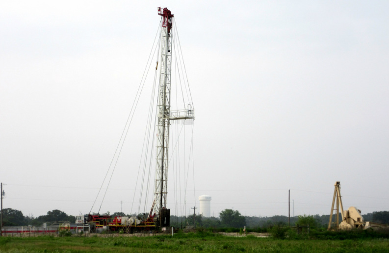
College Station - between Pebble Creek and Foxfire neighborhoods, July 2014
Research Fracking activity in your area via RRC website
Search for drilling permits, wells, pipelines, etc in Texas at the RRC site (the government site that issues drilling permits):
Two main options for searching - by map or using the database search mode:
Enter an address in the upper right search box, click the magnifying glass
Click the ” - “ sign (as many times as necessary) to zoom out on the map a bit (wait a few seconds to see the loading of images)
Click the “Identify” down arrow and click Surveys
You can then drag the pointer to the nearest well and double click it to see the Survey name. Do this for a few wells. You can then later search by Survey name to see more permits/wells in that given Survey area.
Click the Lon Lat to be able to see the GPS address of the spots on the map as you scroll over them.
Click Basemap down arrow and select Topographic map (see if you like this or another view)
Click Identify then Wells, Survey, etc so that when scroll over a well, can see more info on it. Then Double Click the number to see more info about the well.
2. Search by Database (vs via a map):
http://www.rrc.state.tx.us
Click Data- Online Research Queries
Before drilling a permit application must be submitted and approved. Find the drilling permit:
Drilling Permit (W-1) Query Launch Application <<<===== Click this
Then click Drilling Permit (W-1) Query
Search Criteria:
In the COUNTY box scroll down and click Brazos
You can enter any other info (example enter a Survey name for that section of Brazos county)
Dates are helpful to narrow your search, but you might want to leave blank initially to see some of the older wells in your area
click Submit button at bottom of page
When your search results pop up hit the colored fonts to get more detail and info
Clicking the Return button takes you to the previous page
If you have additional Search tips, please email them via the Contact page.
Two main options for searching - by map or using the database search mode:
- Search by Map - Click:
Enter an address in the upper right search box, click the magnifying glass
Click the ” - “ sign (as many times as necessary) to zoom out on the map a bit (wait a few seconds to see the loading of images)
Click the “Identify” down arrow and click Surveys
You can then drag the pointer to the nearest well and double click it to see the Survey name. Do this for a few wells. You can then later search by Survey name to see more permits/wells in that given Survey area.
Click the Lon Lat to be able to see the GPS address of the spots on the map as you scroll over them.
Click Basemap down arrow and select Topographic map (see if you like this or another view)
Click Identify then Wells, Survey, etc so that when scroll over a well, can see more info on it. Then Double Click the number to see more info about the well.
2. Search by Database (vs via a map):
http://www.rrc.state.tx.us
Click Data- Online Research Queries
Before drilling a permit application must be submitted and approved. Find the drilling permit:
Drilling Permit (W-1) Query Launch Application <<<===== Click this
Then click Drilling Permit (W-1) Query
Search Criteria:
- If you have the API number of the well you are interested in - just enter it
- Otherwise to do a search of your area:
In the COUNTY box scroll down and click Brazos
You can enter any other info (example enter a Survey name for that section of Brazos county)
Dates are helpful to narrow your search, but you might want to leave blank initially to see some of the older wells in your area
click Submit button at bottom of page
When your search results pop up hit the colored fonts to get more detail and info
Clicking the Return button takes you to the previous page
If you have additional Search tips, please email them via the Contact page.
